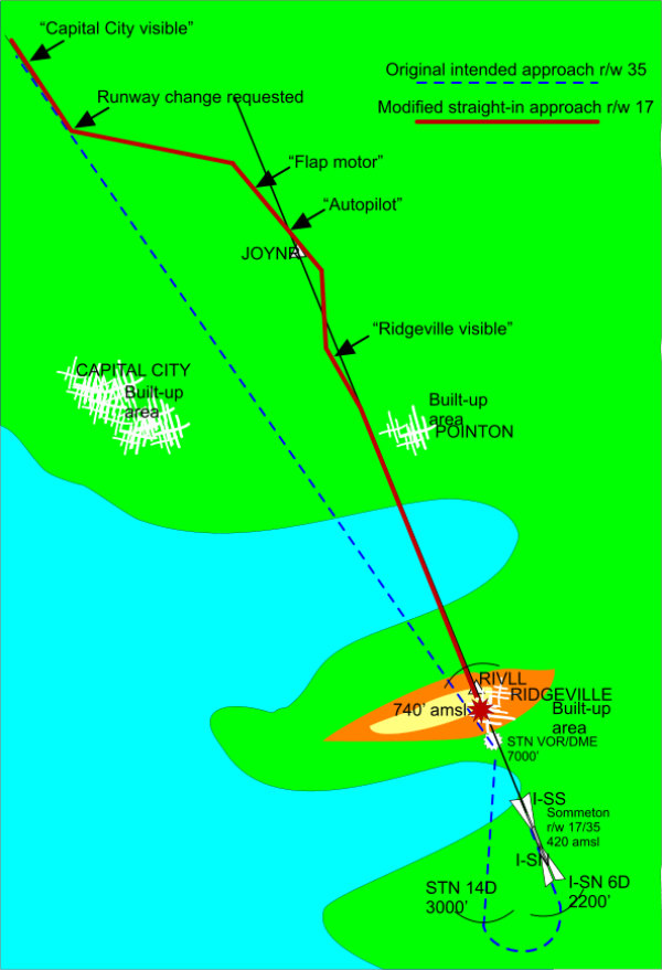
In the subsequent investigation, it transpired that the DME readings and aircraft altitudes corresponded to an accurately flown profile using the DME distances from the ILS DME shown on the 17 approach plate. Unfortunately however the only DME being displayed was that for STN, some 4 miles out on the centre-line.
Consequently the profile was actually flown 1200 feet low, and the aircraft hit the village (Ridgeville) on the ridge north of the bay. Although the aircraft was fitted with GPWS no alerts were triggered, because the aircraft did not penetrate any of the mode boundaries.
The town which the Captain thought he had identified as Ridgeville was actually Pointon, situated in a geographically similar location north of an inlet some seven miles further North.
The actual weather at Sommeton at the time of the accident was visibility 3 km. in haze, cloud 400 ft scattered, 600 broken. Consequently neither Sommeton nor Ridgeville were actually visible from the aircraft at any time .